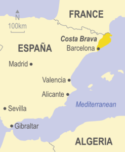
Walking in Ibiza and Formentera
£12.00
27 walks, 3 car tours and 11 cycle tours
by Hans Losse
25% off your next ebook when you sign up to our newsletter! Sign up here.
A guidebook to walking and cycling on the Balearic islands of Ibiza and Formentera, featuring 27 of the best long and short day walks and 11 cycle tours. We cover the whole of both islands, showing trekking and bike routes of varying difficulty, all of which are mapped in detail.
This guide also includes 3 car tours, a touring map, plans of Eivissa (Ibiza Town), Sant Antoni and Santa Eulària and free downloadable GPS tracks.
When to go: The best months for walking on Ibiza and Formentera are March to June and September/October.
Print book: £14.99 / PDF £12.00
![]()
Purchase the complete book as a downloadable PDF using the button below:

Until the sixties, Ibiza belonged to the Ibizans, and only a few artists, poets and writers lived in this paradise. Then the flower-children arrived, the hippies and drop-outs.
In the last decades however, mass tourism has taken over and unfortunately destroyed much of the charm of Ibiza and Formentera. But not everything on the islands has been spoiled, and a visit to the pine islands’ (the ‘Pityussae’, as the Greeks called them) is still worthwhile today.
There’s an unending wealth of hidden beauty spots to be discovered, and this book helps you to find the best of Ibiza and Formentera by car, bicycle, or on foot.
Routes have been recently checked for this new sixth edition of our guidebook to walking in Ibiza and Formentera – and there are two bonuses: firstly, there are now free downloadable GPS tracks for all the treks and cycle tours; secondly, for the adventurous, the author has described a round-the-island hike for which detailed stages and GPS tracks are available on this website (see the ‘GPS tracks’ tab).
As expected from the Sunflower range, this book is a good guide to walking in Ibiza and cycling, backed up with excellent maps. The maps give a clue as to where the best bases are for a walking holiday. The update website facility means that you can keep abreast of route closures and possible obstacles or problems. (Isabella, Amazon)
We love walking and find this book so useful. It is a handy size to fit in the pocket and shows all the wonderful walks, cycle rides and tours possible on the two islands. The detail is great and you simply cannot get lost! It enables the visitor to explore the places that the tourist does not normally get to see. It is an invaluable companion and I recommend it wholeheartedly. (Valerie, Amazon)
If you’re relying on public transport, it’s best to stay in Ibiza Town, since the bus network radiates from the capital. Santa Eulalia and San Antonio are also good bases. If you hire a car, you have far more flexibility. Another good way of accessing walks is the coastal boat services, for which details are provided.
3 car tours, 11 walks, 6 cycle tours and 16 picnic suggestions for Ibiza; also 6 cycle tours and 1 walk for Formentera
136 pages + touring map for each island, plans of Eivissa (Ibiza Town), Sant Antoni, Santa Eulària; large-scale (1:40,000) topo maps
6th ed, 2023; ISBN 978-1-85691-550-2; UK retail price £14.99 / USA retail price $20.00 / euro €16,50
Table of contents:
Preface 5
Acknowledgements; Place names 5
Touring 6
Walking 8
Waymarking and maps 9
What to take with you 10
Where to stay 11
Climate and weather 11
Dogs and other things that bite 11
Spanish for walkers 11
Organisation of the walks 13
Cycling 14
Roads and tracks 14
Equipment and clothing 14
Climate and weather 15
Organisation of the cycle tours 15
Picnicking 16
Country code 17
Ibiza 19
Getting about 20
Plans of Sant Antoni and Santa Eulària 21
Plan of Eivissa (Ibiza Town) 22-3
Car tours
Car tour 1: THE HILLY WEST 24
Eivissa • Ses Figueretes • Sant Josep • Sant Agusti • Sant Antoni • Sant Rafel • Eivissa
Car tour 2: EAST COAST BEACHES 27
Eivissa • Roca Llisa • Cala Llonga • Santa Eulària • Cala Pada • Es Canar • Sant Carles • Cala de Sant Vicent • Sant Joan • Sant Llorenç • Eivissa
Car tour 3: RURAL IBIZA 30
Eivissa • Santa Gertrudis • Portinatx • Cala d’en Serra • Port de Sant Miquel • Sant Miquel • Sant Mateu • Santa Agnès • Sant Rafel • Eivissa
Walks and cycle tours (see grading on page 8)
BASED ON EIVISSA (IBIZA TOWN)
Walk 1: D’Alt Vila • Es Soto • Es Botafoc • Talamanca 32
Walk 2: Talamanca • Puig d’en Manya • Talamanca 35
Cycle tour 1: Eivissa • Cala Llonga • Salt d’en Serra • Eivissa 39
Walk 3: From Platja d’en Bossa to Platja de Migjorn 42
Walk 4: Cap d’es Falcó 45
Walk 5: From Cala Jondal to Sa Canal 48
Walk 6: Torre des Savinar 50
Walk 7: Sant Josep • Sa Talaiassa • Cala Tarida 53
Walk 8: From Sant Joan to Portinatx 59
Walk 9: From Portinatx to Cala Xarraca 63
Walk 10: Torre des Molar from Port de Sant Miquel 66
BASED ON SANT ANTONI
Cycle tour 2: Sant Antoni • Sant Rafel • Sant Antoni 68
Walk 11: Bays west of Sant Antoni 70
Walk 12: The coastal path to Cala Salada 73
Walk 13: Santa Agnès • Penya Esbarrada • Santa Agnès 76
BASED ON RESORTS AROUND SANTA EULARIA
Walk 14: From Santa Eulària to Cala Llonga 80
Walk 15: Puig de Ses Terrets 82
Walk 16: On the flanks of Puig d’en Pep 83
Walk 17: From Santa Eulària to Punta Arabí and Es Canar 85
Walk 18: Santa Eulària and the Puig de sa Creu d’en Ribes 88
Cycle tour 3: Gardens and woods north of Santa Eulària 91
Walk 19: From Es Canar to Sant Carles 94
Cycle tour 4: Es Canar • Sant Carles • Es Figueral • S’Aigua Blanca • Puig d’Atzaró • Can Codolar • Es Canar 97
Cycle tour 5: Es Canar • Sant Carles • Cala Boix • Cala Mastella • Sant Carles • Peralta • Es Canar 98
Walk 20: Circuit from Sant Carles to Cala Mastella 99
Walk 21: From Sant Carles to Cala de Sant Vicent 103
Walk 22: Round Puig d’en Gat 107
Walk 23: Cala Mastella • Torre d’en Valls • Cala Mastella 108
Picnic Suggestions 111 Formentera 115
Cycle tours (based on Es Pujols)
Cycle tour 1: Es Pujols • Sant Ferrán • Sant Francesc • Cala Saona • Cap de Barbaria • Es Pujols 116
Cycle tour 2: Es Pujols • Es Caló • El Pilar • Far de la Mola • Es Pujols 118
Cycle tour 3: Es Pujols • Es Trucadors • La Savina • Porto Saler • Torre de la Gavina • Cala Saona • Es Pujols 120
Cycle tour 4: Es Pujols • Platja de Migjorn • Es Pujols 122
Cycle tour 5: Es Pujols • Punta de sa Pedrera • Torre de la Gavina • Es Pujols 123
Cycle tour and Walk 6 (G): Es Pujols • Sant Ferrán • Es Caló • Camí de sa Pujada • El Pilar • Sa Talaiassa• Es Caló • Es Pujols 124
Picnic suggestions 129
Bus and boat timetables 131
Index 134
Postscript: a round-the-island walk 136
Fold-out touring map (Ibiza) inside back cover
Cycling map (Formentera) reverse of touring map
IBIZA
Aigua Blanca, S’ 97, 104
Airport 43, 48-9, 131
Argamassa, S’ 84-5, 86-7
Balàfia 27, 28
Botafoc, Es 34, 35, 36-7, 38, 40, 111
Cala (small bay, cove)
Bassa 70, 72, 113, 131-2
Benniràs 30, 31
Blanca 79, 80
Boix 98, 110
Codolar 72, 131
Conta see Platjes de Comte d’Hort 26, 50-1
de Sant Miquel 66, 67
de Sant Vicent 28, 103, 104, 105, 131-2
d’en Serra 30, 59, 59, 60
des Multons 66-7, 67, 112
Gració 73, 74, 113, 131-2
Jondal 24, 25, 48-9
Lleyna 94, 95, 100, 131, 133-4
Llonga 12, 27, 35, 36-7, 39, 41, 78, 80, 81, 82, 131, 133-4
Llosar 74, 75
Mastella 95, 96, 98, 99, 100, 101, 108, 110, 113
Molí 26, 54-5
Olivera 36-7, 41
Pada 28, 84-5, 87, 131, 133-4
Roig 70, 72
Roja 36-7, 38
Sa Caleta 24, 25, 48-9
Salada 73, 74, 75
Salt d’en Serra 41, 82, 111, 113
S’Estanyol 36-7, 40
Talamanca 34, 35, 40, 111
Tarida 26, 53, 54-5, 58, 131-2
Vedella 26, 53, 54-5, 131-2
Xarraca 30, 62, 63, 64, 65, 112
Xuclà 30, 63, 65
Caletes, Ses 29
Caló Roig, Es 100, 113
Can Cololar 97
Can Jordi 13, 94, 95, 98-9, 100, 101
Canal, Sa 24, 42, 43, 44, 45, 47, 47, 48-9, 112
Canal d’en Marti 110
Canar, Es 13, 28, 84-5, 87, 94, 95, 96, 98, 131, 133-4
Cap (cape)
d’es Falcó 45, 46, 47, 49
Gros 96, 99
Llentrisca 26
Martinet 35, 36-7, 38, 111,131-2
Negret 73, 74, 131-2
Castellar I, Castellar II 80, 82, 82
Coll (pass)
de Sa Vila 27, 36-7, 40-1
des Rossellons 69
Conillera, Sa (island) 70, 72, 113
Cova Santa 24, 135
Cubells, Es 25, 56
Eivissa 1, 11, 13, 20, 24, 27, 30, 32-3, 34, 36-7, 39, 131-5
town plan 22-3
D’Alt Vila 32-3, 111
Figueral, Es 13, 28, 29, 96, 104, 107, 131, 133
Figueretes, Ses 24
Ibiza Town see Eivissa
Illa (island)
des Bosc 66, 67
Grossa 34, 36-7, 111
Plana 34, 36-7
Jesús 27, 36-7, 40, 41, 131
Na Xamena 30
Penya Esbarrada 76, 77, 113 Pla (plain)
de Corona 6-7, 76, 77
de S’Argentera 95, 98 Platja (beach)
de Migjorn (also called Playa Salinas) 24, 43, 44, 111, 112
d’en Bossa 24, 42, 43, 112, 131
d’es Cavellet 43, 44
des Canal de s’Olla 47
Es Codolar 24, 46, 48-9
Platjes de Comte 71, 72 (also called Cala Conta, 131-2)
Playa Salinas see Platja de Migjorn
Port de Sant Miquel 30, 66, 67, 131-2
Portinatx 30, 59, 60, 62, 63, 131-3
Port de Sant Miquel 30, 66, 67, 131- 2
Portinatx 30, 59, 60, 62, 63, 131-3
Pou des Lleó 110
Puig (high hill, mountain)
d’Atzaró 91-92, 97
de Marina 80, 81
de Missa 27, 29, 80, 84-5, 88-9, 90, 93
de sa Creu d’en Ribes 80, 84-5, 90, 90
de Ses Terrets 80, 82, 82
d’en Gat 98, 103, 104, 106, 107, 107
d’en Manya 36-7, 38
d’en Pep 80, 83, 84
d’en Valls 69, 131
des Jondal 48-9
Falcó 47, 48-9
Nunó 26, 75
Punta (point)
Arabí 84-5, 85, 87
de sa Galera 74, 95
de S’Aguait 83, 113
Grossa 29
sa Torre 62, 63, 112
Roca Llisa 27, 36-7, 41
Roques Altes 53, 54-5
Salines, Ses 43, 47, 48-9
Sant Agusti 26, 54-5
Sant Antoni de Portmany 7, 11, 13, 20, 26, 68-9, 70, 73, 74, 131-3
town plan 21
Sant Carles de Paralta 28, 94, 95, 96, 97, 98, 99, 100, 102, 103, 104, 106, 107, 131, 133
Sant Joan de Labritja 28, 59, 60, 131- 2
Sant Jordi 24, 131
Sant Josep 24, 26, 53, 54-5, 131-2
Sant Llorenç 29, 30
Sant Mateu d’Aubarca 31
Sant Rafel 26, 31, 68, 69
Santa Agnès 6-7, 31, 76, 77, 131-3
Santa Eulària des Ríu 7, 11, 13, 20, 27, 29, 78, 79, 80, 81, 83, 84-5, 88-9, 90, 91, 93, 113, 131-4
town plan 21
Riu de Santa Eulària 78, 79, 80, 83, 88, 90, 113
Santa Gertrudis 30
Serra de Sant Vicent 104
Serra d’en Ballansat 36-7,
Soto, Es (Eivissa) 32, 34, 111
Talaiassa, Sa (highest point on Ibiza) 24, 53, 54-5, 56, 57, 112
Talamanca; see Cala Talamanca
Torre (ancient watchtower)
des Molar 66, 67
de Ses Portes 43, 44
de Portinatx 62, 63
de sa Sal Rossa 42, 43, 112
des Savinar 26, 50-1, 52, 52
d’en Rovira 71, 72
d’en Valls 109, 110
Torrent (stream)
Socarrat 95, 96, 99, 100, 101
Vedrà, Es (rock islet) 26, 50-1, 52, 52, 70-1, 112
Vista Alegre 25
FORMENTERA
Cala Saona (cove) 116, 120-1, 129, 130
Caló, Es 118-9, 124-5, 128
Camí (old mule track or trail)
Antic de la Mola 118-9, 129
de sa Pujada 124, 126, 128, 130
de sa Talaiassa 128
Cap (cape) de Barbaria 116-7, 122, cover
Cavall d’en Borràs 121
Cova Foradada, Sa (cave) 117
Espalmador, Illa (island) 120
Estany (inland water)
d’es Peix 123
Pudent 117, 120-1, 123
Estanyets, Es (salt-pans) 123
Estufador, S’ 124
Far de la Mola 119, 127
Mar y Land (holiday village) 122
Mola, La 118-9
Molí d’es Carregedor 120, 121
Pas, Es 120, 130
Pilar, El 119, 127
Platja (beach)
de Llevant 120, 130
de Migjorn 122, 130
Porto Saler 120, 123
Pujols, Es 116-124, 128, 131, 134
Punta (point) de Sa Pedrera 123, 130
Racó de sa Pujada 124, 125, 128
Salinas d’en Marroig 120
Sant Ferrán 116, 118, 121-2, 124, 131, 134
Sant Francesc 116-7, 120-1, 123, 131, 134
Savina, La 120, 123
‘Tanga Beach’ see Platja de Llevant Torre (ancient watchtower)
d’es Garroveret 117
de la Gavina 123
Trucadors, Es 115, 120, 130
Ibiza and Formentera, 6th edition (2023); updated 20/04/2023
Updates for walks and car tours (drives) on Ibiza and Formentera given below supplement those provided in the guidebook. It is vital that this Update is read in conjunction with the text of the book, but note that the Update applies only to the edition stated and not to any earlier editions. (If you have an older edition of this book you can “upgrade” to the latest edition at half price.) Information has been forwarded to us by users of the book, and Sunflower Books offers the data in good faith but cannot be held responsible for any misleading or inaccurate content in the Update. Unless indicated otherwise, what appears here has not been verified by the author or publisher, so please allow due caution when new or amended routes are suggested. Each piece of information is dated; bear in mind that some of the older observations may have since been overtaken by events or further changes.
If, during your holiday, you are using the current edition of the guide and are able to provide any additional updating to add to this page, we will be pleased to hear from you. Please send information, preferably by e-mail, to info@sunflowerbooks.co.uk.
Buses: Hi, I just made use of your guidebook for Ibiza. Took the bus from Eivissa to Portinatx, and Timetable 7 on page 132 ( Line 20A) is not accurate. Here is the current timetable (April 2023):
Dep Portinatx: 07.00, 08.45, 10.45, 15.30, 17.15, 19.00, 21.00 (Mon-Fri); 09.30, 11.30, 15.30, 21.00 (Sat); 09.30, 11.30, 15.30 (Sun)
Dep Eivissa: 07.45, 09.45, 13.00, 15.10, 16.30, 18.15, 20.00 (Mon-Fri); 08.30, 10.30, 14.30, 20.00 (Sat); 08.30, 10.30, 14.30 (Sun)
User (4/23)
GPS files for use with Landscapes of Ibiza:
Download GPS files for Landscapes of Ibiza.
Download GPS files for round-the-island Ibiza hike.
iPhone users need a free or paid app to open the zip file and see the files stored inside it. There are a variety of apps that can open zip files on the iPhone, but Zip Viewer is one of the easiest to use – and it is free.