")
")
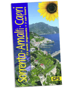


Walking in Sorrento, Amalfi and Capri
£13.00
73 walk segments and 7 car tours
by Julian Tippett
25% off your next ebook when you sign up to our newsletter! Sign up here.
A guidebook to walking in Sorrento, Amalfi and Capri in Italy, featuring 73 walk segments from which to plan the best day walks. This new edition, as well as being thoroughly updated, features the ascent of Monte San Michele and GPS tracks for all the walk segments.
We cover the entire Amalfi (Sorrento) Peninsula, from the famous Amalfi Coast to the foothills of the Lattari Mountains and the island of Capri, describing trekking routes of varying difficulty.
Follow the ancient network of footpaths from the mountains back down to the coast and get away from the crowds on Capri.
This guide also includes 7 car tours, unique ‘walk planners’ and plans of Sorrento, Positano, Amalfi, Ravello.
When to go: The best months for walking the Amalfi Coast are April-June and September-October.
Printed book: £15.99 / PDF book £13.00
![]()
Purchase the complete book as a downloadable PDF using the button below:

One of Sunflower’s most popular guides ever — just look at the Amazon reviews.
Sorrento, Amalfi and Capri are wonderful areas for walkers. The author visits at least once a year to update – but he has ‘eyes and ears on the ground’ as well, so although this is the latest edition with all the changes known to us post-pandemic, always look at the Update page as well for last-minute tips from users or colleagues in this region of Italy.
Accident of history and steepness of terrain have preserved a network of ancient footpaths linking the coastal towns of the Neapolitan Riviera and the surrounding countryside.
You can either climb almost from your hotel doorstep up into the lemon groves or take a bus into the hills and walk back down. All along the way you will visit hillside villages or remote monasteries and be regaled by the most stunning views.
The flowers are a constant delight: from broom and rosemary in March to freesias and cistus in May. In autumn, the woods are carpeted with cyclamen.
Most of the paths can be followed easily by people who do not claim to be regular walkers, though committed hikers will like them just the same.
A trip based on this book was the most enjoyable I have ever had. (Nick, Amazon)
The local holiday rep was so impressed by our local knowledge, courtesy of your book, that she took down details and sent a request to her mother to forward a copy to her! She felt that this was the first detailed guide book to this particular part of Italy. The content, diagrams, maps, and directions are excellent; the pull-out map inside the back cover most useful. (AT, Amazon)
I do not think that there is a better publication for those of us who want to explore the ‘real’ countryside of Europe. (EMW, Crewe)
Sorrento or Amalfi are best for access to local buses and ferries.
7 car tours, 73 walk segments, 17 excursions with picnic
. 160 pages plus two touring/walking maps; plans of Sorrento, Positano, Amalfi, Ravello; 6 walk planners showing the 73 walk segments in the book
.
10th ed, 2023; ISBN 978-185691-540-3; UK retail price £15.99 / USA retail price $21.00 / euro €17,50
Table of contents:
Preface 4
Introduction 6
The Amalfi Peninsula 8
Planning a holiday 9
Getting about 9
Pronunciation guide 12
Eating locally 13
Flora and fauna 15
The footpaths — their nature and origin 16
Hints to walkers 17
The walk planners 19
Guides and maps 21
Excursions with picnic 23
Touring 28
Tour 1: CIRCUIT FROM SORRENTO 30
Tour 2: SANTA MARIA DEL CASTELLO AND MONTE FAITO 33
Tour 3: MONTEPERTUSO AND NOCELLE 34
Tour 4: THE AGEROLA PLAIN 35
Tour 5: POGEROLA 36
Tour 6: PONTONE 36
Tour 7: TRAMONTI 38
Panel: Major sights outside the region 40
Amalfi/Ravello (Walk segments 1-17) 42
Plans of Amalfi and Ravello 44-45
Walk segments and planner 46-47
Positano/Praiano (Walk segments 18-33) 70
Plan of Positano 71
Walk segments and planner 72-73
Conca dei Marini (Walk segments 34-39) 95
Walk segments and planner 96
Maiori/Minori (Walk segments 40-46) 106
Walk segments and planner 106-107
Sorrento (Walk segments 47-65) 118
Plan of Sorrento 119
Walk segments and planner 120-121
Capri (Walk segments 66-72) 142
Walk segments and planner 143-144
Monte San Michele (Walk segment 73) 152
Bus timetables 154
Useful websites 158
Index 159
Fold-out area map inside back cover
Agerola 8, 25, 35, 46, 72, 86
Amalfi 8, 11, 12, 20, 23, 24, 25, 28-9, 35,36, 37, 42-3, 44, 45, 46, 47, 48, 49, 52, 53, 54, 56, 58, 59, 60, 61, 62, 95, 96, 102, 103,
Town plan 44
Anacapri 27, 41, 142, 143, 144, 146-7, 148, 149, 154
Annunziata 30, 128, 132
Arco Naturale 143, 144, 145
Atrani 8, 14-5, 20, 23, 24, 25, 28, 36, 42, 46, 47, 48, 49, 50, 51, 56, 64, 65, 66-7, 154
Bomerano 35, 43, 46, 72, 73, 83, 86, 87, 91, 92, 154
Campidoglio 47, 57, 107
Capo 27, 154
Capri 4-5, 9, 11, 20, 22, 27, 30-1, 41, 43, 120, 121, 126, 127, 136-7, 142, 143, 144, 146, 148, 150, 157, 158
Caserma Forestale 73, 77-80
Colle la Serra 73, 83-7
Colli di Fontanelle 31, 32, 118, 120, 121, 137-40, 141, 154
Colli di San Pietro 70, 72, 73, 88, 90, 91, 118, 137, 138, 154
Conca dei Marini 20, 26, 28, 46, 59, 95, 96, 101, 102, 154
Erchie 107, 109, 154
Ercolano (Herculaneum) 11, 40
Grotte (path junction) 73, 96, 104, 105
Iaconti 107, 117
Ieranto 120, 133, 134
I Trasiti 78-9
Lattari (mountains) 8, 18, 27, 42, 62, 78, 80, 88, 139, 152
Lone 47, 58, 59
Maiori 8, 12, 16, 20, 26, 28, 38, 39, 106, 107, 108, 109, 110- 1, 112-5, 116, 117, 154
Marina del Cantone 26, 27, 30, 31, 120, 134, 135, 154
Marina della Lobra 120, 132, 133 Marina di Furore 73, 92, 93, 94, 96, 98, 100-2
Marina di Puolo 120, 121-3
Marina Grande 142, 143, 146, 147, 154
Massa Lubrense 22, 27, 30, 118, 120, 121, 123, 124-5, 128-33, 154
Minori 8, 12, 20, 25, 26, 28, 42, 47, 52, 53, 54, 64, 66, 68, 69, 106, 107, 108, 109, 111, 112, 116, 154
Minuta 47, 54-7, 62, 63
Monte Comune 76, 77, 78-9, 88-9, 90
Monte Faito 27, 33
Monte San Costanzo 135, 136
Monte San Michele 8, 27, 33, 152, 153
Monte Santa Croce 120, 135, 136-7
Monte Solaro 27, 142
Montepertuso 26, 34, 70-76, 156
Napoli (Naples) 4, 8, 11, 33, 35
Nerano 26, 31, 120, 121, 133-5, 154
Nocelle 26, 34, 70-2, 73, 75-7, 78-9, 83-8, 154
Paestum 28, 40
Pantano 13, 20, 21, 120, 122, 123
Pastena 47, 58, cover
Pianillo 35
Pogerola 19, 23, 36-7, 42, 43, 47, 52, 59-62, 96, 154
Polvica 106, 107, 112, 114, 154
Pompei 4, 11, 28, 40
Ponteprimario 113
Pontone 37, 47, 54, 55, 56, 61, 62, 64, 67
Positano 8, 10, 11, 12, 20, 22, 26, 28, 32-3, 34, 35, 43, 44, 70, 71, 72, 73, 74-6, 78-9, 80-1, 82-84, 88, 121, 154
Town plan 71
Positano (Bar Internazionale) 70, 71, 73, 75, 81, 82
Praiano 8, 12, 20, 28, 70, 72, 73, 83, 85, 86, 91-4, 104, 154
Pucara 107, 115
Ravello 1, 6-7, 8, 12, 14-5, 20, 24, 25, 36, 38, 42, 43, 45, 47, 49, 50-1, 52-8, 64, 68, 69, 107, 111, 154
Town plan 45
Recommone 27, 120, 134, 135
Salerno 11, 12, 22, 28, 40, 41, 43, 154
Sambuco 107, 111
San Costanzo 31, 120, 126; see also Monte San Costanzo San Domenico (convent) 2, 73, 85-7, 88
San Lazzaro 19, 20, 25, 35, 43, 46, 47, 95, 96, 97, 98, 99, 104, 105, 154
San Nicola (convent) 106, 107, 111
Sant’Agata 22, 31, 118, 120, 121, 126-9, 130-1, 132, 137, 139, 140, 141, 154
Santa Caterina 56, 57
Santa Maria 30, 120, 126-9, 132, 133
Santa Maria del Castello 32-3, 73, 79, 80-1, 82, 83, 88, 90
Santuario dell’Avvocata 16, 22, 106, 107, 109, 110, 113, 115, 117
Scala 43, 47, 54, 56, 57, 72
Sentiero Abu Tabela (footpath) 104, 105
Sentiero degli Dei (Footpath of the Gods) 10, 35, 72, 82, 83, 86, 87, 104
Sentiero dei Fortini (footpath) 143, 149, 150
Sorrento 4, 8, 9, 11, 12, 21, 26-33, 40, 43, 228, 119, 120, 121-7, 131, 132, 138-9, 154
Town plan 119
Spiaggia di Conca dei Marini 26
Termini 9, 26, 30-1, 117, 120, 121, 126, 127, 128, 134-7, 154
Torello 25, 47, 50, 52, 54, 64, 66
Torre Damecuta 4-5, 143, 148, 149
Torre dello Ziro 46, 47, 51, 53, 55, 64, 66-7, 68
Tovere 20, 96, 98, 101-3
Tramonti (plain) 8, 21, 38-9, 106, 112, 113, 114
Trugnano 107, 114
Valle dei Mulini (Valley of the Mills) 23, 36, 42, 47, 54, 60, 61, 62, 68
Valle delle Ferriere 47, 62, 63 Vesuvio (Vesuvius) 4, 32, 49, 40, 122, 138-9
Vèttica Maggiore 28, 70, 72, 73, 84, 85, 87, 91-4, 154
Vèttica Minore 95, 102, 103
Villa Cimbrone 1, 8, 24, 25, 345, 46, 49, 50-1, 116
Villa di Pollio 27, 120, 121, 122
Villa Jovis 143, 144
Villa Rufolo 6-7, 45, 54
Sorrento and the Amalfi Coast,10th edition (December 2022); updated 19/01/24
Note 1: If you have an older edition of this book you can ‘upgrade’ to the latest edition at half price.
Note 2: The following updates are annotated “9th” or “9th/10th” implying they refer to either just the 9th edition or both 9th and 10th editions, respectively.
Information has been forwarded to us by users of the book, and Sunflower Books offers the data in good faith but cannot be held responsible for any misleading or inaccurate content in the Update. Unless indicated otherwise, what appears here has not been verified by the author or publisher, so please allow due caution when new or amended routes are suggested. Each piece of information is dated; bear in mind that some of the older observations may have since been overtaken by events or further changes. If, during your holiday, you are using the current edition of the guide and are able to provide any additional updating to add to this page, we will be pleased to hear from you. Please send information, preferably by e-mail, to info@sunflowerbooks.co.uk.
Note 3: The current 10th edition is a little larger than previous editions, allowing more expansive use of photographs, and the inclusion of four significant new routes.
General Warning: When stone-paved paths are wet they can be very slippery. This affects mostly the sloping paths behind Sorrento and on Capri where there are fewer steps. So, take care.
Note on SITA buses: During the busy tourist months SITA buses are often so heavily used that special measures are advised. If boarding the bus at the originating location, usually Amalfi or Sorrento but other locations also, then it can pay to board the bus with a good length of time to spare. The 10.15 bus from Amalfi to Agerola which serves the Path of the Gods is a particular case in point.
Also, when wishing to board the bus at intermediate points, have a Plan B up your sleeve in case the bus whizzes past full. At busy times the buses sometimes have difficulty keeping to the timetable.
9th/10th Segment 1: If you intend going down to the sea-front, the steps down at the far end of the tunnel are closed for repair. To get to the sea-front from the west end of the road tunnel, return half way along the path outside the tunnel to find steps going down. (Author 10/22)
9th/10th Segment 12: A recent landslide (March 2023) blocked the popular path out of Amalfi into the Valley of the Mills. This is located just a little after the entrance to the valley where the path leaves the houses of Amalfi. The path was blocked at first but quite quickly walkers created a diversion below the landslide. This diversion, though unofficial, has become well established and is easy to follow. (Author 01/24)
9th/10th Segment 13: Walk planning tip: those wanting an extended walk in the hills flanking the coast could combine this segment with Segment 34 Pogerola to San Lazzaro. However, instead of descending into Pogerola to finish Segment 13 so as to pick up Segment 34 from its start, you can cut across from one to the other staying in the hills. To do this: at the prominent path fork (page 53, next to last line) take the right fork. This path now takes a gradually ascending route, keeping the slope up on your right. Look for intermittent CAI marks, and at path forks tend to take the upper (right-hand) choice. After about 1km/0.6mi you come to a spring Acquolella at the foot of the rocky gully that divides Monte Molignano on the left from the main mountainside on the right. Ascend this gully; at its top reach a broad path that climbs to the next corner of the mountain, where it curves right. Shortly Segment 34 joins from the left. Continue on Segment 34. (Author 2/13)
9th Segment 14 a: The first two sentences change to: ‘From the Piazza Umberto with its drinking fountain, take the road away from the sea under the church clock tower. Just before it ends take steep narrow steps behind a small playground on the right, signed Pontone and Ravello.’ (Author 1/21)
9th Segment 30: Page 77. Near the bottom from ‘• At the top’ substitute these directions: • At the top, go through a zizag stile onto an area of pasture and make your way to the summit of Monte Comune, marked by a large wooden cross. Here turn right and descend on a faint track with a fence some 100m/yds down to the right. After 300m/yds the track curves gently left and heads for woodland. • Here find a zigzag stile by a direction sign. Pass the stile and take a narrow path into the wood with good CAI marking. After about 300m/yds, watch for the path turning left, to transfer to the crest of the next ridge. Follow the CAI marks down a rocky stretch to a T-junction at a stout wooden fence. • Turn right, to follow the fence (at first) and down a flight of wooden log steps to a junction with a track. Turn right onto a path along the rim of the slope on the right and follow this for 400m/yds, until you reach a paved road by two buildings. Just past these the road bends left. Here either turn right on Walk segment 24a to Positano, or turn left, then right, for Santa Maria del Castello (and the bar/restaurant ‘Zi Peppe’). (Author 10/20)
9th/10th Segment 36: The section from the covered shrine down to the marina is still closed. Should you wish to visit the marina and connect to segments 32 or 33, then the following allows you make a detour around the closed section:
9th/10th Segment 36a: From the covered shrine, take the road down for 30m/yds, to find steps descending to a road at a hairpin bend. Continue the few yards ahead down to the next hairpin and here take a path ahead. After a short stretch, a path goes right to descend 300m/yds to the coast road. Turn right here and walk 600m/yds to the road bridge over the marina.
9th/10th Segment 36b: From the road bridge over the marina walk east (direction Amalfi) for 600m/yds to a left bend. Just beyond this a flight of steps rises 300m/yds to a T-junction with another path. Turn left to reach a road at a hairpin bed. Go right ahead to the next bend, from where a stepped path takes you to a higher road and very shortly to the covered shrine. Author 10/20)
Segment 38. The path between Vettica Minore church up the wild hillside to the water supply building at Tovere (east side) is now in serious doubt. You might be able to follow the route in the book, but for safety reasons it is advisable to follow these diversions. (Author 01/24)
9th/10th Segment 38a: Having reached the main road just above Vettica church, turn left for 300m/yds to a hairpin bend. Here pick up a stepped path up to rejoin the main road and follow this up to a tunnel. Through the tunnel you reach the Santa Rosa building, a hotel. Immediately opposite the hotel take steps up. This Segment 37a. Follow its directions until you reach the water supply building at Tovere (east side).
9th/10th Segment 38b: From the water supply building at Tovere (east side) follow Segment 37a to the Santa Rosa Hotel, main road and road tunnel. Walk through the tunnel and, after 200m/yds, take steps down to the right to rejoin the road. Continue down the road for 300m/yds to just before Vettica church. Here take steps down right. Now continue on Segment 38b.
9th/10th Segment 41: All went well until we reached line 3 on page 92: “Turn right and continue past a waymark to a cistern“. After passing the waymark and before reaching the cistern, a very large tree had fallen across the path, blocking the path completely. A rough route had been hacked out through heavy vegetation to the right of the path, climbing up steeply through the overgrown terracing, and then making its way back to the path, 50m/yds or so beyond the cistern. When reaching the level path again, be sure to retrace the path back to the cistern, otherwise you will miss ” … a short steep rocky descent alongside a small stream. ” mentioned at line 6 on page 92. The cistern itself is completely hidden by vegetation until you are close enough to touch it, although you can hear the water dripping in/out of it. (User, 10/13)
9th/10th Segment 44:
Update 1: The bus from Maiori, 2km after leaving Polvica, might not turn right to Capitignano. In this case after passing an obvious turning to the right, alight immediately in the next Village, Pietre. Here take the road off to the right from the village centre which leads in 1km to Capitignano.
Update 2: Just after the village of Pendolo the way ahead goes through lemon terraces with a sheer wall on the left and a sheer drop on the right. To continue on this route brings you after 10 minutes to an impassable landslip. Instead, there is a track leading up to the left marked with red/white marks. Follow this which will take you past the landslip and back down to the main route, heading for Novella.
Update 3: After Pucara and having crossed the main road you are on a minor road signed Paterno. After 300m do not go left in front of the mill as the onward path has become overgrown. Instead continue on the minor road. After 300m more cross a stream to a T-junction. Turn left and ascend after 300m to a hamlet and, after 100m more, to a right-hand bend. Here a path ascends to the left on the right hand side of a house. You are now on Segment 43, line 11 on page 95. Continue round a side valley…to the end of the segment. (User 05/19)
9th/10th Segment 45b: From the start of the segment there are now fewer red spots to guide you down to the picnic site (30 min). Also, on the way down to the site there are now two junctions to negotiate — first a T-junction. Turn left. Second, either straight ahead or go right — go right. (User 05/19)
9th/10th Segment 64a: At the highest point of Via Rocca, at the crossroads of narrow roads, the road you take to the right is now concreted. The road to the right of the wiggle 300m further on has been recently concreted and now looks like a private driveway. Do not be put off. (User 09/18)
Segment 65: The top of steep slope below the Malacoccola viewpoint has been damaged by a fire in September 2023. Extra care is needed when walking this section, as follows.
9th/10th Segment 65a: After the ‘superb picnic spot’ (line 14), read: Now follow CAI marks for 100m/yds (towards a lone island)looking for the start of a path descending steeply to the right. This slope was badly burned and the wooden handrail have been either badly damaged or burned completely away. Having located the route of the path descend very carefully down its rocky line. The continue to descend the steep rugged hillside to the top edge of a wood.
9th/10th Segment 65b: 10 lines from the end look for ‘To do this…’: To do this the CAI marks take you half-left above the wood and then directly up the hillside. As you near the top you will come to the badly burnt part of the route. The path is very rocky and the wooden handrail has been so badly damaged as to be useless. Take great care. At the top go left for 100m/yds to the grassy promontory with its superb picnic spot.
Download GPS files for Sorrento and the Amalfi Coast.